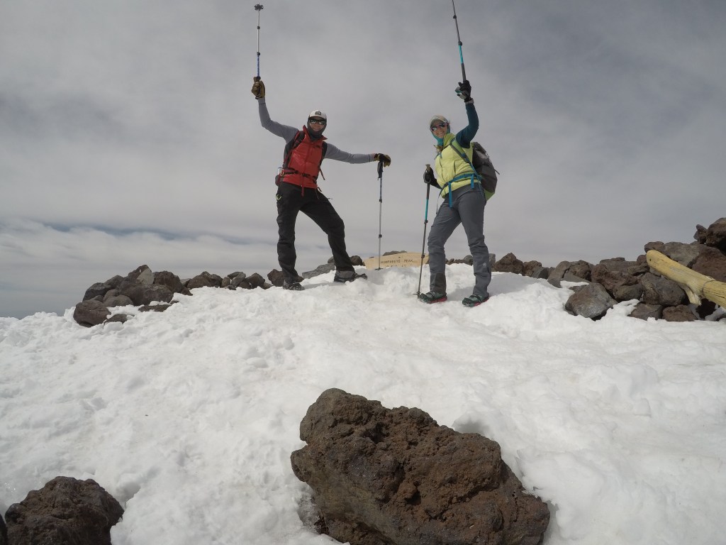
Humphreys Peak, the highest point in Arizona, stands at 12, 633 ft (if you go by the sign at the summit).
Arizona’s high point rests in the Coconino National Forest and neighbors the Arizona Snowbowl Ski Resort. If you arrive to the state via plane into Phoenix, you are in for a treat. In April, Phoenix is still 80+ degrees at 10pm. There is almost no green and for a northerner it is pretty much always uncomfortable. Flagstaff is just a 2 hour drive north. As you you make the drive, you see the most beautiful changes.
Phoenix sits at just over 1,000 ft. Where as Flagstaff reaches to near 7,000 ft. The landscape, the flora and the temperature all morph as you leave the heat of Phoenix and enter the pine forests of Flagstaff.

Depending on what time you start your day-Macy’s European Coffeehouse is delicious. Not a ton of seating, but you can get breakfast to go for your drive.
The drive from Flagstaff to the trailhead is just under 30 minutes, and located at the ski resort. The trailhead parking lot did not have a bathroom however so plan accordingly.
You can check out any updates at the trailhead and get a better look at the route from the posting at the start like any other trailhead. We went in April (still winter season) and no permit was required.
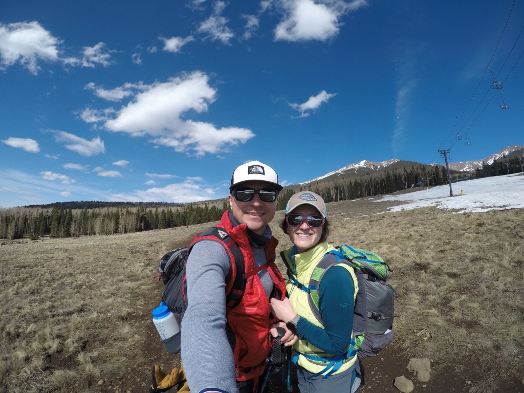
The actual route starts by walking under the chair lift, and snow depending you might actually walk across a ski run; so be respectful and don’t forget to look uphill.
Before long you’re in the shade in the forest, so bring your layers. The shade also means that if the snow is melted in areas of direct sun, it won’t necessarily be melted within the trees. In April the route was pretty hard packed, as long as you stayed on the worn path, snowshoes weren’t necessary. If you stepped OFF that pack, the snow was unconsolidated and you drop at least to your knees-so be careful, check the forecast for recent snow and plan your footwear accordingly. Regardless of your footwear choice-traction and trekking poles are necessary. Micro-spikes, Yaktrax or snowshoes if that makes sense for you will all work.
The route is well traveled as you take switchbacks through the forest. As you leave the forest and cross a scree field to the ridge, keep note of your location. Coming back down we struggled in this area, about 11,500ft. The route is not as well marked and it a bit ‘choose your own adventure’ and not every path is the best choice.
Once you reach the ridge, it is breezy and the views are superb.
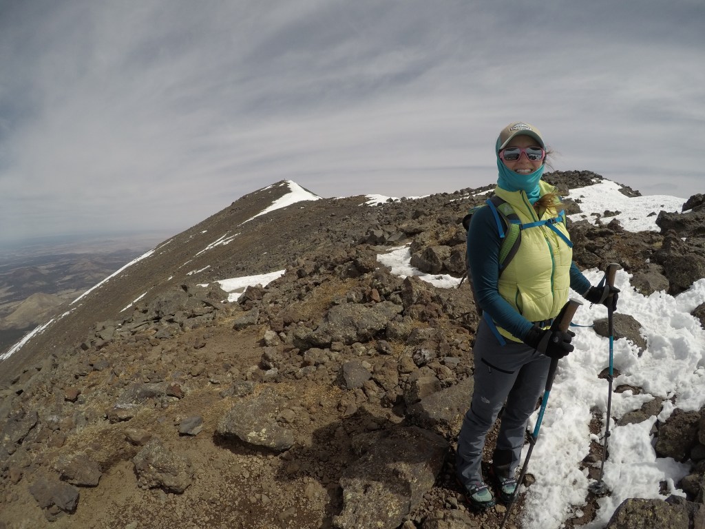
The last portion of the hike treats you to several false summits and a view of Arizona I certainly did not expect. Overall a wonderful hike and great in the cooler months.
The hike took us 8 HOURS! 5 weeks prior, Brandon had surgery to repair his fractured tibial plateau. For us, the decent in slightly melted snow (which we anticipated) was difficult with a less then perfect set of knees.
Round Trip miles: 9.5
Total Elevation Gain: 3,566 ft
Check another High Point off your list (if you’re into that kind of thing) and be super proud of your day. At over 12,000 ft this hike is no slouch. Have fun, but be prepared!
Once you’re back in Flagstaff-enjoy yourself! Dark Sky Brewing is delicious. It sits high on my list for both pizza and beer, that’s saying something.

Thanks for reading folks! Safe travels and enjoy some Days off!